The South Island has roughly 1,500 km between Farewell Spit and Bluff, and almost all of its best places sit on or near a sealed road. This guide lists 50 of them by region — Marlborough and Nelson, the West Coast, Canterbury, the Mackenzie, Otago, the Southern Lakes, Fiordland and Southland — with what each is actually like.
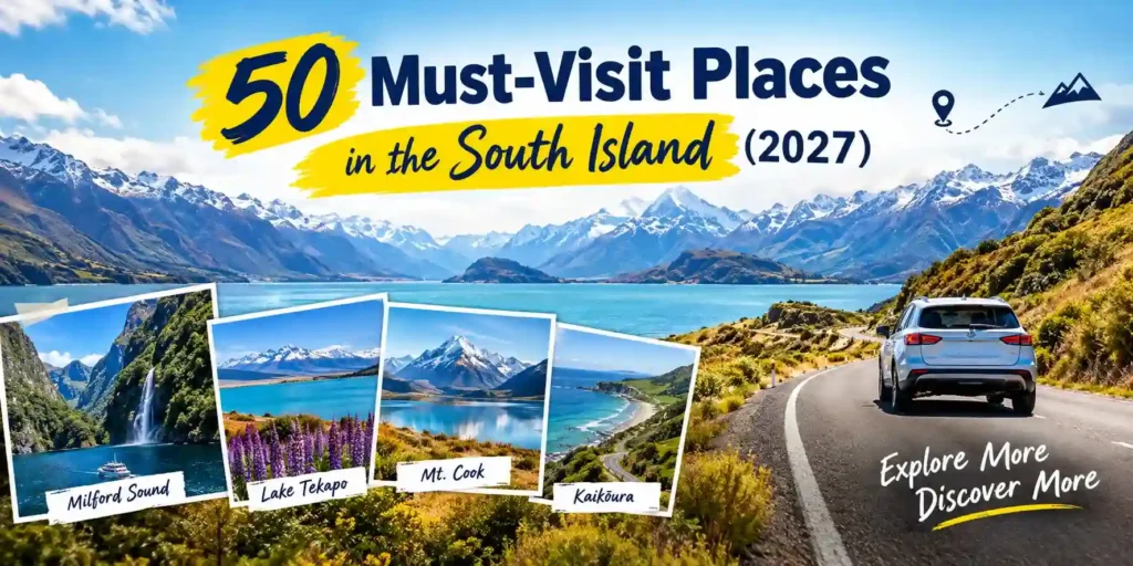
The South Island is about 150,000 square kilometres with roughly a million people in it. That ratio is the whole point: you can drive for an hour between two of the most photographed places in the country and pass four cars.
This is the long list — 50 places, organised by region so you can plan a route rather than a wishlist. Each entry says what it is, what it costs you in time, and whether it’s worth the detour.
Nobody sees all 50 in one trip. Pick a region, or two next door to each other.
Table of Contents
ToggleThe regions below run roughly north to south. If you’re flying into Christchurch, the natural splits are:
Almost everything here needs a car. There’s no rail link to Queenstown, Te Anau or the glaciers, no bus down most of the roads on this list, and nothing at all on the Milford Road. We’ve set out the case in full in why a rental car beats public transport in the South Island — the summary is that the places worth stopping at are the ones no timetable serves.
Before you book, it’s worth knowing what you need to hire a car in New Zealand — licence rules, the insurance excess, and whether your overseas licence needs an IDP.
The sunniest corner of the country, and the one most road trips skip because it’s furthest from Queenstown.
New Zealand’s smallest national park and its most forgiving — golden beaches, clear water and a coastal track you can walk in sections. Water taxis let you walk one way and boat back, which is how most people do it.
Around three-quarters of New Zealand’s wine comes from here, most of it Sauvignon Blanc. The cellar doors cluster around Blenheim and Renwick, flat enough to cycle between, which solves the designated-driver problem neatly.
Drowned river valleys full of bush-covered islands. The Queen Charlotte Drive from Picton to Havelock is 35 km of tight corners and constant views — slow, and worth it.
A mountain range that drops almost straight into a deep ocean trench, which is why whales, dolphins and seals are all reliably here year-round. The seal colony at Point Kean costs nothing.
Lake Rotoiti’s jetty is one of the most photographed in the country, usually with ducks on it. The Bellbird Walk takes 20 minutes; St Arnaud village sits at the lake edge.
A 20-minute walk over farmland and dunes to arches, caves and usually seal pups in the rock pools. Exposed, wild, and nothing like the sheltered beaches an hour away.
A 26 km sandspit curving east from the top of the island, and an internationally significant bird habitat. Public access is limited to the first few kilometres — the rest is by licensed tour only.
Rainforest, glaciers and 600 km of coast road with very few people on it. It rains a lot. Go anyway.
Limestone stacked in layers like pancakes, with blowholes that perform at high tide. The loop walk takes 20 minutes and is wheelchair accessible. Check the tide table — at low tide the blowholes do nothing.
Turquoise water that looks artificially coloured, from glacial rock flour suspended in it. A swing bridge and a 30-minute loop, about 33 km inland from Hokitika on a sealed road.
Worth knowing before you go: you can no longer walk onto the glacier from the valley floor. The walk is about 30 minutes to a viewpoint, with the Waiho River blocking access beyond. Getting onto the ice means a helicopter. Parking is $2.50 per half hour, card only.
Same rule applies — valley viewpoints only, hundreds of metres from the face, and the track closes regularly for rockfall and flooding. Lake Matheson nearby is the better-known photograph: Aoraki and Tasman reflected in still, tannin-dark water, best within an hour of dawn.
New Zealand’s largest unmodified wetland, and the only place white herons nest. Kayaking it at dawn with the Southern Alps behind is one of the quietest experiences on the coast.
A 30-minute return walk over two swing bridges to water so clear that the trout look suspended. Right on SH6, so it costs almost nothing to stop.
Limestone arches the size of cathedrals in dense rainforest, reached by a narrow gravel road past Karamea. Remote enough that you’ll likely have the Moria Gate arch to yourself.
The first place in the Southern Hemisphere to get a public electricity supply, in 1888. A small gold-rush town with its Victorian main street intact, and the gateway to Victoria Forest Park.
The widest plains in the country, with the Alps behind them and Christchurch in the middle.
The Botanic Gardens and the Avon are the obvious ones. The more interesting story is the rebuild — the Transitional Cathedral, Quake City and the street art that filled the gaps are worth half a day.
A drowned volcanic crater 75 minutes from Christchurch, with a French-settled village in the bottom of it. The Summit Road around the crater rim is the drive; Hector’s dolphins are the reason people take the harbour cruise.
The only road crossing the Alps in central Canterbury, topping out at 920 m. The Devils Punchbowl Falls walk is an hour return. Kea in the village car park will dismantle your windscreen wipers given the chance.
A field of enormous limestone boulders on SH73, sacred to Ngāi Tahu and world-famous among boulderers. Ten minutes from the car park and visible from the road.
Thermal pools in a forested basin 90 minutes north of Christchurch, open year-round. The most popular winter day trip from the city, and the one that works in any weather.
The closest commercial ski field to Christchurch, usually with the longest season in the South Island. The access road is steep, unsealed in sections, and chains are regularly required — we’ve covered the drive in detail in our Mt Hutt ski-season driving guide.
The milky blue of the Rakaia where it leaves the mountains, crossed by a 1882 bridge on SH72. The gorge walkway runs 10 km one way along the cliffs.
Christchurch’s port, through a road tunnel under the Port Hills. A working harbour town with a strong food and music scene, and the departure point for Quail Island.
Tussock, turquoise lakes and the clearest night sky in the country. If you only do one region, this is the one.
The Church of the Good Shepherd on the lakeshore is the most photographed building in New Zealand. Go at dawn or dusk, and walk five minutes along the shore for the same view without the crowd.
Tekapo sits inside the Aoraki Mackenzie International Dark Sky Reserve, one of the largest in the world. The Mt John summit road carries a small vehicle toll; the walk up takes about an hour.
Larger and emptier than Tekapo, with Aoraki standing at the far end on a clear day. The signposted lookout on SH8 is the single best roadside view in New Zealand and costs you ten minutes.
The country’s highest mountain at 3,724 m. The Hooker Valley Track is flat, three swing bridges, three hours return, and finishes at a glacial lake with icebergs floating in it. The best short walk in New Zealand, and it doesn’t require you to be fit.
New Zealand’s longest glacier, with a terminal lake that didn’t exist in 1970 and is now several kilometres long. The viewpoint walk takes 40 minutes return.
Eroded pinnacles and ravines in ancient gravel, on private land with a small honesty-box fee. A 10 km detour from SH8 onto a short gravel road.
Schist, stone fruit, gold-rush history and a coastline full of wildlife.
At 971 m, the highest point on the South Island’s state highway network. Bare golden tussock for 30 km with nothing built on it. Two signposted pull-offs near the summit — use them rather than stopping on the road.
150 km of former railway line from Clyde to Middlemarch, flat, unsealed and ridable in three to four days. The original cycle trail in New Zealand and still the most popular.
The Bannockburn sluicings are a moonscape left behind by gold miners’ water cannon. Cromwell’s historic precinct sits on the edge of Lake Dunstan, with Central Otago’s Pinot Noir cellar doors spread around both.
New Zealand’s best-preserved Victorian and Edwardian city. The railway station, Larnach Castle, and Baldwin Street — the world’s steepest residential street at a gradient of about 1 in 2.86 at its steepest point.
The only mainland royal albatross breeding colony in the world, at Taiaroa Head, plus yellow-eyed penguins and sea lions. All within 40 minutes of central Dunedin.
Spherical concretions scattered along Koekohe Beach, formed over millions of years in ancient seafloor mud. Check the tide — at high tide they’re half submerged, at low tide you can walk around them.
The best-preserved Victorian precinct in the country, built from local white limestone. Also a steampunk museum and a blue penguin colony that comes ashore at dusk.
Weathered limestone boulders in a paddock in the Waitaki Valley, used as a filming location for Narnia. Free, open, and usually deserted.
The Southern Lakes. Busiest part of the island, and the place most first-time visitors picture when they picture New Zealand.
The adventure capital, and genuinely good at it — bungy, jet boats, skiing and the Skyline gondola. Also crowded and expensive in January. The lake and the Remarkables behind it are free.
A gold-rush main street 20 minutes from Queenstown, with the Chinese Settlement preserved at the end of it. Late April is the best autumn colour in New Zealand, and it is genuinely worth timing a trip around.
46 km of sealed road along Lake Wakatipu, about 45 minutes each way, and one of the great drives. Beyond Glenorchy the road to Paradise turns to gravel — check your rental agreement first.
The highest sealed through road in New Zealand, topping out at the Crown Saddle at 1,076 m. Steep on both approaches, frequently requires chains between June and September, and the descent to Queenstown is the drive people remember.
Quieter than Queenstown and increasingly less so. That Wānaka Tree stands in the lake shallows at Roys Bay; the lakefront walk is flat and free.
The most photographed viewpoint in the country — a ridgeline above Lake Wānaka reached by a relentless 16 km return climb of about 1,200 m. Allow five to six hours. Closed annually for lambing, usually October to mid-November — check before you plan around it.
The Kawarau Gorge wine region 25 minutes from Queenstown, with cellar doors along SH6 and the original commercial bungy site at the Kawarau Bridge. Sort a driver first — New Zealand’s limits are lower than most visitors expect.
The emptiest corner of the country, and the wettest.
Mitre Peak rising 1,692 m straight out of the water. From Te Anau it’s 120 km each way and an eight-hour day; from Queenstown it’s a 600 km round trip taking 12 to 14 hours. There are no shops or fuel stations between Te Anau and Milford — fill up and buy food in Te Anau, and book your cruise before you drive.
Three times longer and ten times larger than Milford, reached only by boat across Lake Manapouri and then a bus over Wilmot Pass. Far fewer people, and the overnight cruises are the quietest nights you’ll spend in New Zealand.
The gateway to Fiordland and the last proper town before Milford. The glowworm caves across the lake are reached by boat; the lakefront track is flat and runs for kilometres.
A stretch of coast between Balclutha and Invercargill holding Nugget Point lighthouse, Purakaunui Falls, Cathedral Caves and the fossil forest at Curio Bay. Yellow-eyed penguins come ashore at dusk. Allow a full day minimum.
The signpost at the end of SH1, and the departure point for the Stewart Island ferry. Bluff oysters are in season roughly March to August and are worth planning around.
New Zealand’s third island, 85% national park, reached by a one-hour ferry from Bluff or a 20-minute flight from Invercargill. One of the few certain places to see kiwi in the wild, and a certified International Dark Sky Sanctuary.
Seven days covers one coherent loop — typically Christchurch, the Mackenzie, the Southern Lakes and back up the Otago coast. Our 7-day South Island road trip from Christchurch sets out that route day by day with drive times.
Ten to fourteen days lets you add the West Coast or Fiordland without turning the trip into a driving marathon.
Three weeks is what it takes to do the whole island, top to bottom, at a pace where you stop when something looks good.
The mistake is treating a list like this as a checklist. Half the places above reward an unplanned hour far more than a scheduled thirty minutes.
If you’re flying out of Queenstown rather than returning to Christchurch, you don’t need to drive the island twice — one-way hire from Christchurch to Queenstown saves roughly two days.
December to February — long daylight, all passes open, warmest weather, and every popular place at its busiest. Book accommodation months ahead in the Mackenzie and Southern Lakes.
March to April — the best all-round window. Settled weather, thinner crowds, and Central Otago autumn colour peaking in late April.
May to September — ski season. Snow on the passes, chains at times, shorter days, lower prices and far fewer people. Alpine walks like Roys Peak and the Milford Road need real care.
October to November — spring. Passes reopen, rivers run full with snowmelt, lupins flower through the Mackenzie in November, and prices haven’t peaked.
Christchurch is the practical starting point for most of this list — the South Island’s largest airport, the widest choice of vehicles, and a central position that puts both the inland and West Coast loops within reach without backtracking.
Boss Auto Rentals hires from 38 Rich Terrace, Wigram, Christchurch and 4 Marble Court, Rolleston.
Affordable, reliable car rentals in Christchurch , Rolleston & Queenstown. Perfect for tourists, families, and travelers exploring Canterbury and the South Island.
